News
Our stories ... ...
Suriname - 04 November, 2014
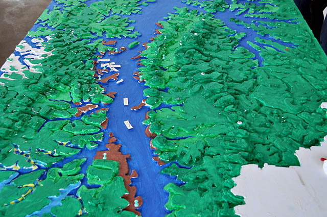
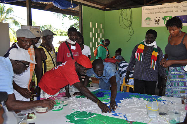
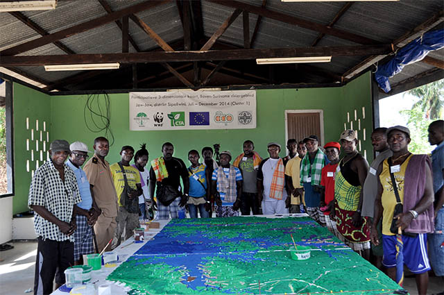
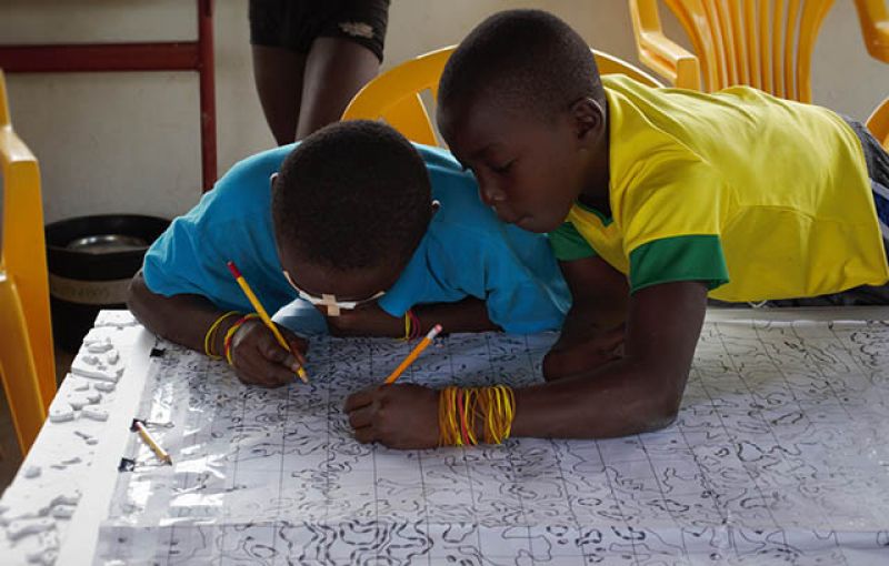
A three-dimensional map of the upper Suriname River has been developed through participatory mapping by local communities of the Saramaccan ethnic group in Suriname. Children, women, men and elders worked together during 10 days to build the map that represents their territory in 34 aspects relevant for their orientation, livelihoods and culture.
The mapping activity and the final map allowed the local community to identify their territory and its importance for their livelihoods as it has been expressed by Mr. Stiefen Petrusi of the Association of Saramaccan village leaders: ‘It is important that people who are not familiar with the area are aware of the significance of a creek or plant. They will learn how important the forest is to villagers and thus understand us better.’ Furthermore the younger Saramaccans became more aware of their traditions and history, and the communities now have a visual tool to deal with other stakeholders regarding the use and management of their territory.
The whole exercise was documented in the video “The enabling power of participatory 3D mapping among the Saramaccan People of Suriname” and presented during the 13th Caribbean Week of Agriculture, October 8 and 9 2014, in Paramaribo, Suriname. In this event various representatives of the community had the opportunity to present the map and explain the process that led to the formulation of the map legend, its fine-tuning and updating.
In the near future a digital version of the map will be made using the datasets that were captured using high-resolution digital photography and will be digitized and imported into a Geographical Information System.
This participatory mapping activity has been developed within the framework of the project “Multi-scale modeling of ecosystem services and land-use scenarios in the upper Suriname River basin” in collaboration with Tropenbos International Suriname, the Association of Saramaccan village leaders (VSG), WWF and the Technical Centre for Agricultural and Rural Cooperation ACP-EU (CTA).